
The Local Transport Project has delivered significant improvements to walking, cycling and sustainable travel across Boscombe, helping create safer routes, reduce reliance on car travel and improve connections between key destinations.
The project forms part of a wider Better Boscombe approach to encouraging active travel, improving road safety, and reducing airborne pollutants, particularly in areas close to schools and residential streets. Investment has focused on practical, on-the-ground improvements that make it easier and safer for people to move around the area on foot, by bike or by public transport.
The majority of delivery has now been achieved, with final elements scheduled for completion by mid-March 2026 following some technical challenges during construction.


Improving local transport infrastructure plays a key role in creating a healthier, safer and more accessible Boscombe. The Local Transport Project has contributed to:

The Local Transport Project has delivered a coordinated set of improvements across key routes, particularly along Ashley Road and Christchurch Road, where congestion and pedestrian safety were identified as priorities.
Completed and near-complete works include:
The 20mph road markings and signage have now been installed, with the exception of one zone entry sign on the A35 Christchurch Road near Warneford Road, which is due to be completed following minor adjustments to the pole location.
Together, these measures improve safety, support active travel and help reduce vehicle speeds in busy areas.
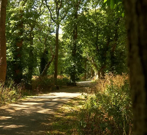
Improvements to Woodland Walk form an integral part of the Local Transport Project, providing a safe and attractive route that supports walking and cycling between the seafront, Christchurch Road and Boscombe town centre.
While Woodland Walk improvements are delivered in partnership with BCP Greenspace and The Parks Foundation, they contribute directly to Transport Project outcomes by:

The project has also supported sustainable transport options through funding the No. 99 Beach Bus, which operated a circular route every 30 minutes during summer seasons between Pokesdown, Boscombe Centre and the seafront from April 2023 to October 2024.
This service helped reduce short car journeys, improve access to the seafront and town centre, and support visitor movement across the area.
Revised MHCLG targets reflect the full scope of delivery across the project. All targets are expected to be 100% achieved by mid-March 2026.
Some elements have progressed more slowly than originally forecast due to technical challenges on site, but delivery remains on track for full completion.


The Local Transport Project has a total budget of £1,064,400, with £958,500 expected to be expended by project completion.
Funding sources include:
MHCLG Grant Funding Breakdown
Transport and public realm improvements are a vital part of Boscombe's long-term regeneration. This project has helped create safer streets, stronger connections and more sustainable travel options, supporting healthier lifestyles, improved air quality and a more accessible town.
By encouraging walking, cycling and public transport use, the Local Transport Project contributes to a Boscombe that is easier to navigate, safer to move around, and better connected for residents, students and visitors alike.

The majority of the works are now complete and the remaining minor works are programmed to be implemented by October 2025.
Side road entry treatment is where the carriageway is raised to the same level as the footway in the sideroad, creating a raised table with ramps either side for vehicles to enter/exit the side road. The raised carriageway aims to slow traffic entering the side road and aids pedestrians to cross the side road,, especially the elderly, wheelchair users and those using pushchairs.
These not only provide a convenient level place to cross side roads for pedestrians walking along the main road, but also includes the following benefits:
Improved pedestrian safety, accessibility and convenience.
A 'gateway' feature to indicate the transition from a primary or secondary street to a local street or tertiary, signalling the need for drivers to behave differently in the new environment.
Ensure equal mobility and accessibility for all groups, including people with disabilities, children and older people.
Pelican and Puffin crossings provide a controlled safer system to cross a carriageway for pedestrians using signals to control the movement of motorised traffic.
These are for pedestrian use only.
Both crossing uses a pedestrian operated push button to stop the traffic and an illuminated red and green man is used to signal when pedestrians are to cross the road.
Both crossings include a tactile cone under the push button unit, which rotates when the green man symbol is lit and may include an audible signal (beeping sound) too which indicates when it's safe to cross.
The Pelican crossing provides a set timed period for pedestrians crossing.
Pedestrians operate the crossing by pressing the button located on the signal pole adjacent to the tactile paving, then wait until the traffic stops and the green man is lit on the traffic pole on the opposite side of the road. before crossing.
The Puffin is an updated version of the Pelican as , it is fitted with a detector that automatically varies the crossing period to ensure itit's that the crossing is clear before allowing vehicles to proceed.
The green/red man is located on the signal pole above the wait/push button and not on the opposite side of the road. This is to encourage pedestrians to look at the traffic as well as the lit red/green man.symbol.
All new pedestrian only signalised crossings will be Puffins crossing while and existing Pelican crossings will be phased out with new Puffin equipment.
It's been proven that by reducing vehicle speeds, the likelihood of a collision occurring and its severity is significantly reduced.
Collision data from around the world shows the faster a vehicle is travelling the more likely a collision will occur because the driver has less time to react, stop or avoid the collision, thus resulting in more severe injuries.
There is a 20% chance of pedestrian fatality when hit at 30mph compared to a 2.5% chance at 20mph1
A 12% reduction in casualties in first year of 20mph limits in Brighton2.
21% lower injury odds for those who cycle following the introduction of 20mph limits alone3.
TFL shows that since 20mph limits were introduced on key roads in London in 2020, the number of overall collisions reduced by 25%.
Collisions involving vulnerable road users decreased by 36% and those involving people walking decreased by 63%, while collisions resulting in death or serious injury reduced by 25%.
Each road will be clearly signed at the start of the 20mph speed limit, with upright 20mph static signs and 20mph roundels (road markings).
Due to current average speeds, it is unlikely the lowering of speed limits from 30mph to 20mph will change existing journey times during the day.
Engagement Hub:
30-32 Royal Arcade, Boscombe,
Bournemouth BH1 4BT
email [email protected]
© Bournemouth Towns Fund 2024. All rights reserved. Website by Studio Global

Bournemouth Towns Fund